
Alone in the Void [Part 5]: The Summit of Mount Whitney: The Roof of the Contiguous U.S. (Day II)
“A profound sense of accomplishment washed over me, replacing the disappointment of my last attempt with an overwhelming sense of pride.”
~ Higher than before, inside and out
Table of Contents
7:50AM Finally!
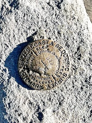
Finally, four and a half hours after leaving my tent at Trail Camp, the moment I had been training for over the past nine months arrived. Standing there, I looked down to see a sight I’d been anticipating for so long—the small bronze disk fixed to the rock, the U.S. Coast & Geodetic Survey Benchmark, signifying Mount Whitney’s elevation of 14,505 feet. The wind was crisp against my face, and the vastness of the landscape stretched out before me. A profound sense of accomplishment washed over me, replacing the disappointment from my last attempt with an overwhelming sense of pride. This was the culmination of countless hours of preparation, the mental and physical challenges, and every ounce of effort I had put into this solo journey.
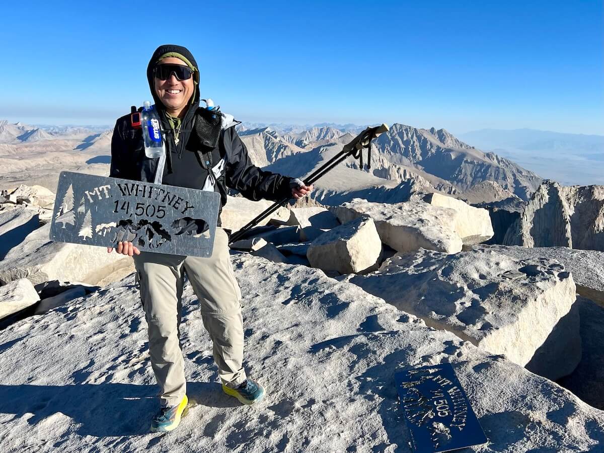
Strangely, when I reached the summit, only four others were there, with a quiet, peaceful stillness hanging in the air. I asked a fellow summiteer to snap a few obligatory photos of me holding the newer metal summit sign (which had replaced the old broken wooden ones) to commemorate the occasion. I felt immense pride in having made it to the highest point in the contiguous U.S. Yet, despite the joy, a sobering realization set in—the journey wasn’t over. I still had to descend, with 11 long miles between me and my car.
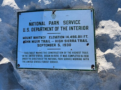
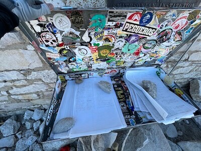
Moving away from the summit plaque and geodetic marker to allow others to take their photos, I turn and head toward the shelter and the flat metal box containing the summit registry. Opening it carefully to avoid letting the loose pages blow away, I scan the registry for the next available spot to sign. It appears that I’m the 16th person to summit today and likely the 9th from the east, Whitney Portal side of the mountain. The first seven summiteers seem to have finished the great John Muir Trail (JMT), likely arriving for sunrise from Guitar Lake to the west—a view I can only imagine. These hikers began their southbound (SOBO) journey 2 to 3 weeks ago from the iconic Happy Isles trailhead, more than 200 miles north in beautiful Yosemite, California. What an amazing accomplishment.
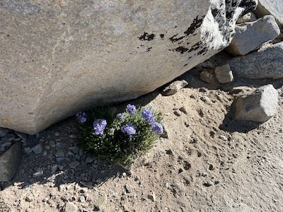
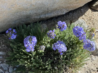
Then, I found a somewhat secluded flat rock to rest on. Amazingly, even at this altitude, a small cluster of Sky Pilot (Polemonium eximium) flowers was blooming beside me, their purple-blue petals a striking contrast against the rocky, barren surroundings. It was incredible to see such delicate beauty thriving in an environment so harsh and unforgiving. This little flower was yet another reminder of the mountain’s quiet power, sharing its beauty in unexpected ways, even in the most extreme conditions.
I spent 30 minutes consuming two more strawberry-frosted Pop-Tarts, electrolytes, and water. I say “consume” because eating and drinking suggest hunger or enjoyment—neither of which I felt. Altitude tends to strip you of both, sometimes even causing nausea, which is why many hikers “bonk” on the trail; they don’t eat or drink enough. But I knew that fueling consistently, regardless of how I felt, was critical to making it back safely.
After resting, I reminded myself that reaching the summit is only half the battle. I strapped on my second knee brace and tightened my back brace, fully aware that the descent would be the hardest on my joints. This is often where injuries occur—when fatigue from lack of sleep, the post-summit adrenaline dump, and the brutal descent all converge. Dropping 6,000 feet in elevation over eleven miles was no small feat, and I needed to remain alert and careful for the trek back to Whitney Portal. Time to move on—I was only halfway there.
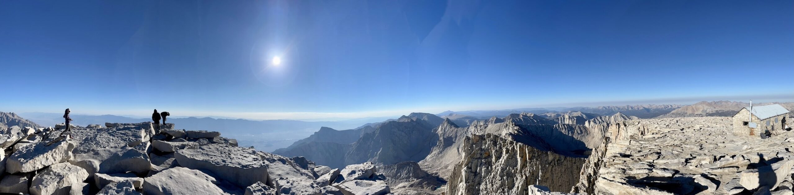
During my 30-minute break at the summit, the once-quiet sounds of the peak began to change as the chatter of voices grew louder. To my amazement, what had been an almost-empty summit was now crowded with over 30 people, all exalting, taking selfies, and waiting in line to sign the summit registry. I instantly felt a wave of gratitude for the advice I’d received from fellow hikers the night before, urging me to start earlier. The solitude I experienced at the summit with only four others now felt like an incredible stroke of luck. Early bird gets the worm, I guess.
As I gazed out over the vast landscape, the joy of reaching the summit was undeniable. But in that quiet moment, I realized that summits aren’t just destinations—they’re checkpoints. The real measure of success lies in the journey back. The descent, often an afterthought in the thrill of the climb, would require just as much focus, discipline, and care as the ascent. The mountain wasn’t done with me yet.
8:20 AM – Descent to Trail Crest: Focus and Refuel
Exhilarated from my successful summit, I begin my slow and steady descent, making my way back toward Trail Crest. As I traverse the familiar ridgeline, I continue to refuel mechanically, knowing that, despite having no real appetite, it’s crucial to keep my energy up. I alternate between GU Energy Gels—occasionally a caffeinated one for an extra boost—Stroopwafels, water, and Liquid I.V. Hydration Multiplier + Probiotic (Tart Green Apple flavor). The key is to stay fueled for the long descent ahead.
My HydraPak Flux water bottle, conveniently nestled in its sleeve, and my Smartwater bottle filled with electrolytes, hooked onto my Zpacks Aqua Clip, are both fixed to my shoulder straps for easy access while walking. This setup allows me to hydrate without stopping, ensuring I stay consistent in replenishing both fluids and electrolytes as I make my way down.
As I descend, I pass several weary hikers pushing toward the summit. I offer words of encouragement—”you’ve got this” or “not much further”—knowing how much it can mean at this stage.
🤝 Trail Etiquette: Yielding and Encouragement
Uphill hikers have the right of way, as maintaining momentum is much harder on the ascent. As a downhill hiker, take a moment to pull aside and let them pass. A word of encouragement can go a long way for those pushing toward the summit—especially when exhaustion sets in. It's all part of the camaraderie that makes these challenging hikes so special.
10:00 AM – Trail Crest: 99 Switchbacks, 1 Ranger, and a Permit Check
Seemingly in the blink of an eye, I’m back at Trail Crest, where the trail has come alive with hikers making their way toward the summit. Some are likely backpackers from Trail Camp, but most are probably day hikers from Whitney Portal, having started their journey between 11PM and 2AM the night before. As I descend, I spot a friendly-looking ranger in a tan uniform. He greets me with a smile and, to my surprise, asks to see my Whitney Wilderness Permit—even though I’m already on my way down.
I begin to remove my trusty Zpacks Arc Haul Ultra pack to retrieve it, but he stops me. “Is your permit visible back here?” he asks. I tell him it’s tucked into the mesh pocket on the back of my pack, where it should still be visible. “No need to take your pack off,” he says. “I can grab it from here.” He takes a quick look, confirms it’s in order, and neatly tucks it back into place.
We chat briefly about fly fishing for Golden Trout in the nearby Golden Trout Wilderness. He mentions he’s hoping to get out on a fishing trip soon. I thank him for his hard work in keeping all of us on the mountain safe. After congratulating me on my summit, we part ways—he continues upward, and I continue my descent.
Unsung Heroes of the Wilderness
It’s refreshing to see how pleasant and dedicated these park rangers are. They have an unenviable job managing permits, aiding lost or injured hikers, and keeping the wilderness pristine so people like me can enjoy it. I have a deep appreciation for all park rangers, as well as the Inyo County Search and Rescue (SAR) team—mostly volunteers—who often venture out in any conditions to help hikers in need. These unsung heroes make adventures like mine possible, ensuring the trails remain safe and well-protected.
As much as summiting feels like a solo achievement, encounters like this remind me that it’s never truly a solitary journey. The park rangers, SAR teams, and volunteers are always there, working quietly in the background to keep the wilderness accessible and safe.
11:30 AM - Back to Trail Camp, Time to Take a Break and Pack Up
Finally, I’ve safely descended 2,500 feet to my tent at Trail Camp. My collapsed tent (I took the trekking poles with me this morning) is exactly as I left it—no marmot holes to be seen! I take an hour here to refuel with more electrolytes and snacks before breaking down my tent and packing everything away. Even my wag bag (which, yes, stores human waste), double-bagged in a secondary ziplock, gets carefully packed into my backpack so that… well, you know why.
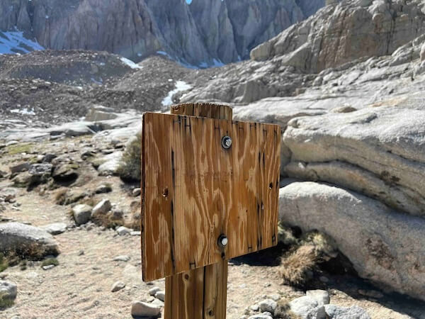
I’ve got enough water to make it to Trailside Meadow, where I’ll top off my supply for the final stretch down the mountain. I do a thorough sweep of the campsite to ensure I’ve left no trash or debris behind—an old but essential habit from my Boy Scouting days. The Leave No Trace principles are always top of mind on trips like these, and I carry an extra ziplock bag in my pocket, not only for my own trash but for any litter I come across. There’s a quiet satisfaction in knowing I’ve done my part to preserve these wild spaces, leaving them pristine for others to enjoy. I set off eagerly down the trail, passing the odd, square wooden sign that, if you squint, might just say “Trail Camp.” Time to finish the journey!
12:30 PM - All Packed, Time To Head Out
With everything packed up and secured, it’s finally time to leave Trail Camp. The sun sits high in the sky, signaling the start of the descent. There’s a certain satisfaction in this moment—gear stowed, the hardest parts of the climb behind me, and the trail stretching out ahead. I take one last glance at the high, rugged peaks, a reminder of how far I’ve come. Now, it’s all about making the journey back down, savoring each step as I move closer to the trailhead.
Conclusion: The Journey Down Begins, But Not Without Twists
Reaching the summit of Mount Whitney was everything I had hoped for—a moment of triumph after months of preparation. But standing at the highest point in the contiguous U.S. is just part of the story. The descent is where the real test begins, requiring focus, patience, and a careful balance between fatigue and determination. Yet, even with the summit behind me, the mountain has more surprises in store—a familiar wrong turn and an unexpected message to deliver. As I pack up at Trail Camp and prepare for the long journey back to Whitney Portal, the mountain has one more reminder for me: the summit may mark the high point, but it’s not the end of the challenge. What new twists will the trail throw my way? And how will I navigate the remaining miles?
An amazing journey! Perhaps one day I will try to follow your footsteps to Mt Whitney. .
Your story telling is a special spiritual journey for me and encouraging messages to help me to continue my training as I prepare for my own hike up to Mt Fuji. I’m most appreciative for your advice as I am new to the trekking scene.
Thanks!